Approved By Design
Topographic Survey
Topographic Survey
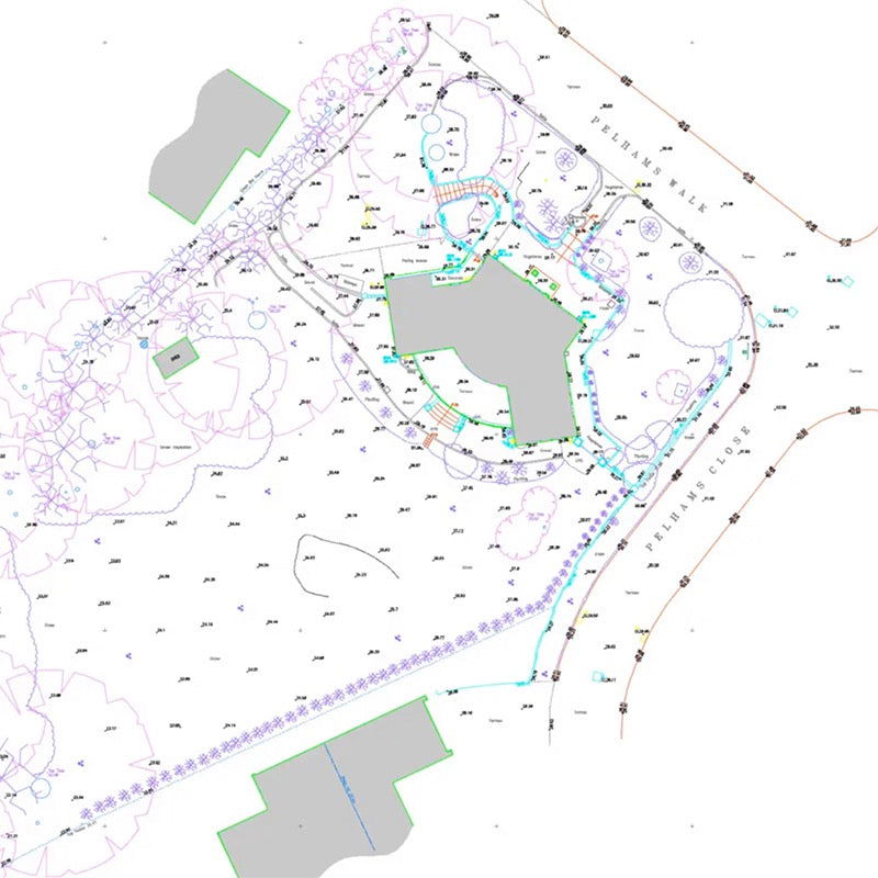
Topographic surveys serve to show physical structures, man-made and natural, including trees and vegetation, buildings, boundaries, surface changes and ground levels.
AXD have experience in carrying out accurate cost effective, Topographic Surveys for a wide range of sectors and clients, including, Architects, developers, private individuals, building contractors and designers, adapting the level of detail required to suit the client’s needs and budget. Surveys can range from back garden surveys, which enable planning applications and landscaping work to entire streetscape surveys that incorporate underground utilities.
All Our Surveys Are Delivered To RICS Specification
All surveys are carried out to RICS specification, Measured Surveys of Land, Buildings and Utilities. drawings can be output in 2D or 3D, delivered in the following formats.
Robotic Leica instruments and Laser Scanners allow us to accelerate the survey process and with the combination of reflector-less technology ensures measurements are possible remotely and safely.
We are flexible with the delivery of our data , drawings can be co-ordinated to local/arbitrary grid or by means of our supplied GPS, RTK rovers we can fix the survey to the Ordnance Survey national grid and level datum.
Typical Uses
- Utility Surveys
- Drainage Surveys
- Boundary disputes
- Level and volume surveys
- Tree Surveys, Arboricultural Surveys
- Waterways/ flood risk
Deliverables
- 2D DWG
- 3D DWG
- Revit BIM Model
- Sketchup
- Achicad
- Printed Hard Copy Drawings
Complete the Form Below for a Free Quotation. We respond to all enquires within 24 hours.
Share


Let customers speak for us
from 32 reviewsI am very happy with my purchase and the service I received from Ax who is the manager of the company. I very highly recommend this business.

Massive sink holds everything and looks good too

Great service, quick delivery even to non-standard locations and great quality of a product!

Really love the look of this fireplace. A bit slow to arrive, but quality takes time right?
Happy with the purchase, and the design team at AXD kept me in the loop throughout. Thanks Alex, you really made this process easy. Just wish I had more living rooms to get more of them.

The attention to detail and quality is evident in every product. Definitely a top choice for architectural solutions.

Quick responses and effective solutions. Their customer service is what every company should aspire to offer.

I appreciate the stackable discounts for our bulk order. They really understand the needs of larger projects.

Reliable, creative, and easy to work with. I’m thoroughly impressed by their professionalism and dedication.

Every step of the way, the service was impeccable. They even offered a complimentary site visit after my purchase, ensuring that all specifications were met before installation. Plus, the unexpected follow-up call was a refreshing touch of genuine customer care.

A wonderful experience! Their bespoke products really made our space unique and personal.

The bespoke products are top-notch, and the follow-up to ensure I was happy with everything confirmed I made the right choice. The team’s professionalism and care were evident throughout the process.

Amazing experience from start to finish. The free site visit to ensure the order was correct showed their proactive approach in providing the best customer service. Also, the follow-up call was a thoughtful gesture that didn't go unnoticed.

They provided detailed explanations and transparent pricing. Felt very informed every step of the way.

I can't praise this company enough! The after-sales service, including a check-up call and a site visit, was beyond what I expected. They truly go the extra mile for their customers.

Loved the eco-friendly options! It’s great to work with a company that prioritizes sustainability.


