Approved By Design
3D Laser Scanning
3D Laser Scanning
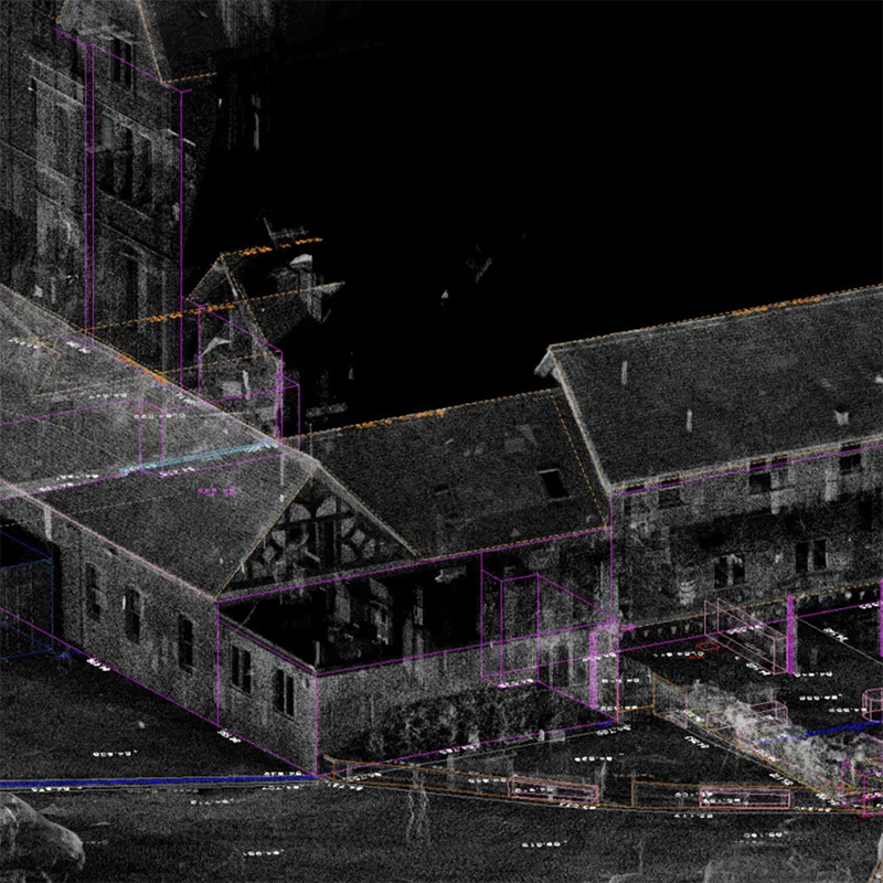
3D Laser Scanning is a process of High Definition Surveying (HDS), it allows reality capture of up to co-ordinated points per second. The combination of its long range, speed and remote capability result in data collection that was never possible with conventional survey techniques and significantly cuts down on site time and increases safety. This efficient and cost effective service allows millimetre accuracy for a wide range of projects from residential to industrial plant.
AXD implement the use of the latest Leica technology with integrated high definition cameras that collect photographs with each scan producing realistic, rich, 3D point clouds allowing complex structures and surfaces to be accurately surveyed and viewed with outputs to suit the client’s needs and project requirements.
AXD have successfully employed the use of Laser scanners in challenging situations that are difficult to measure due to access and level of detail required.
A wide variety of format options allow importing into most 3rd party CAD software with deliverables ranging from 2D floor plans and elevations to 3D rendered surfaces, solids and fly throughs.
Trueview, allows measurement and co-ordinate display from panoramic views.
Benefits of 3D Laser Scanning
- Remote capture
- Fast data capture
- High detail
- Reduce cost by eliminating re-visits
Deliverables
- 2D deliverables - Plans, Sections, Elevations, Topographic Survey
- 3D models - BIM, DWG, Revit, 3D topographic surveys
- Mesh Models
- Coloured Point clouds
- Fly-throughs
- Visualization
Complete the Form Below for a Free Quotation. We respond to all enquires within 24 hours.
Share


Let customers speak for us
from 32 reviewsI am very happy with my purchase and the service I received from Ax who is the manager of the company. I very highly recommend this business.

Massive sink holds everything and looks good too

Great service, quick delivery even to non-standard locations and great quality of a product!

Really love the look of this fireplace. A bit slow to arrive, but quality takes time right?
Happy with the purchase, and the design team at AXD kept me in the loop throughout. Thanks Alex, you really made this process easy. Just wish I had more living rooms to get more of them.

The attention to detail and quality is evident in every product. Definitely a top choice for architectural solutions.

Quick responses and effective solutions. Their customer service is what every company should aspire to offer.

I appreciate the stackable discounts for our bulk order. They really understand the needs of larger projects.

Reliable, creative, and easy to work with. I’m thoroughly impressed by their professionalism and dedication.

Every step of the way, the service was impeccable. They even offered a complimentary site visit after my purchase, ensuring that all specifications were met before installation. Plus, the unexpected follow-up call was a refreshing touch of genuine customer care.

A wonderful experience! Their bespoke products really made our space unique and personal.

The bespoke products are top-notch, and the follow-up to ensure I was happy with everything confirmed I made the right choice. The team’s professionalism and care were evident throughout the process.

Amazing experience from start to finish. The free site visit to ensure the order was correct showed their proactive approach in providing the best customer service. Also, the follow-up call was a thoughtful gesture that didn't go unnoticed.

They provided detailed explanations and transparent pricing. Felt very informed every step of the way.

I can't praise this company enough! The after-sales service, including a check-up call and a site visit, was beyond what I expected. They truly go the extra mile for their customers.

Loved the eco-friendly options! It’s great to work with a company that prioritizes sustainability.


